Log in
All resources
Create a design
337 Free Artworks of Maps Of Lakes
maps of africa
africa in the 1890s
smithsonian libraries
titicaca
bolivia
natural history
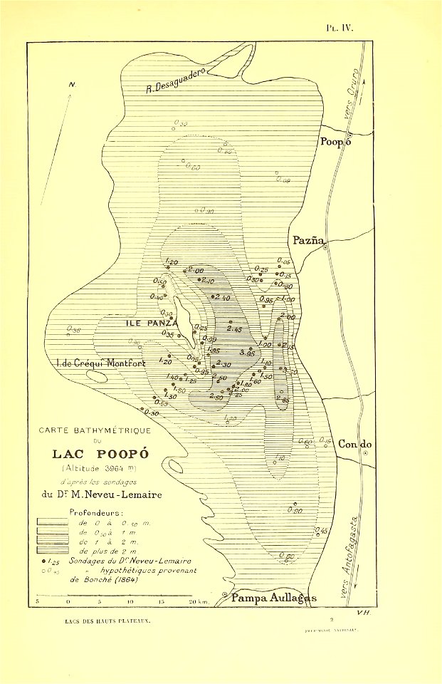
poopó lake (bolivia)
lake (peru and bolivia)
les lacs des hauts plateaux de l'amérique du sud
maps from the earth and its inhabitants, vol. x
1801 maps of europe
maps by john cary
maps in the british museum
maps facing southeast
1830s maps of switzerland
1834 maps of europe
maps by jean-baptiste bourguignon d'anville
maps by thomas kitchin
cityscapes of duluth, minnesota
lake freighters
maps of ghardaïa province
maps of ouargla province
maps from the earth and its inhabitants, vol. x
1890 maps of egypt
atlas maior, vol 11 (asia) - joan blaeu, 1667 - bl 114.h(star).11
1667 maps
salzkammergut in upper austria
maps of salzkammergut
maps from the earth and its inhabitants, vol. x
maps of africa
maps from the earth and its inhabitants, vol. x
1890 maps of africa
maps from the earth and its inhabitants, vol. x
1890s maps of egypt
maps from the mechanical curator collection
through the subarctic forest (1896) by pike
curt teich postcard archives, curt teich & company
postcards of lake tahoe
bathymetric maps of the indian ocean
topographic maps of asia
maps from the earth and its inhabitants, vol. x
1890 maps of africa
maps from the earth and its inhabitants, vol. xii
africa in the 1890s
maps from the earth and its inhabitants, vol. xii
africa in the 1890s
maps from the earth and its inhabitants, vol. x
1890 maps of africa
old maps of lake constance
old maps of swabia
1810 maps of north america
1810 maps of mexico
1800s maps of the world
old maps of the world
voyages and travels to india, ceylon, the red sea, abyssinia, and egypt, vol. 3
henry cooper (engraver)
maps from the earth and its inhabitants, vol. xi
africa in the 1890s
maps from the earth and its inhabitants, vol. xi
africa in the 1890s
john berney ladbrooke
1830 lithographs
maps from the earth and its inhabitants, vol. xii
africa in the 1890s
maps from the earth and its inhabitants, vol. x
1890 maps of africa
maps from gallica
guides joanne
backs of postcards in curt teich postcard archives
maps from the earth and its inhabitants, vol. xii
africa in the 1890s
maps from the earth and its inhabitants, vol. xii
africa in the 1890s
maps from the earth and its inhabitants, vol. xiii
africa in the 1890s
perusinus ac tifernas (galleria delle carte geografiche)
ignazio danti
maps from the earth and its inhabitants, vol. xiii
africa in the 1890s
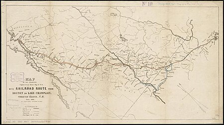
rail transport maps of massachusetts
1845 maps
maps by john cary
1799 maps
english-language maps
1747 maps of asia
maps from the earth and its inhabitants, vol. xiii
africa in the 1890s
maps from the earth and its inhabitants, vol. xii
africa in the 1890s
novus atlas sinensis
old maps of hunan
18th-century maps of north america
1708 maps of north america
maps from the earth and its inhabitants, vol. x
geography of egypt
maps from the earth and its inhabitants, vol. xii
africa in the 1890s
maps from the earth and its inhabitants, vol. iv
topographic maps of scotland
maps by joachim bormeester
1680s maps of the world
1747 maps of new hampshire
english-language maps
maps from the earth and its inhabitants, vol. xii
africa in the 1890s
atlas maior, vol 11 (asia) - joan blaeu, 1667 - bl 114.h(star).11
1667 maps
maps of lindau (bodensee) by braun & hogenberg
lake constance in bavaria in art
maps by john cary
county of tyrol
maps indicating exploration
1885 maps
mountains and lakes in cumberland and westmoreland (1808)
maps in the british museum
mountains and lakes in cumberland and westmoreland (1808)
maps in the british museum
maps from the earth and its inhabitants, vol. x
19th-century maps of africa
topographischer atlas der schweiz
maps of lake lugano
1760s maps of the americas
jean janvier
chicago and the midwest, newberry library
1703 maps of north america
maps in the library of congress
novus atlas sinensis
pamir mountains
hindu kush
pamir mountains
hindu kush
merian sueviae
baroque
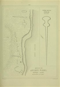
narrative of the defence of kars, historical and military (1857) by lake
maps from the mechanical curator collection
maps from the earth and its inhabitants, vol. iv
topographic maps of scotland
maps from the earth and its inhabitants, vol. xi
africa in the 1890s
gallery of geographical maps (vatican museums)
fucine plain
maps in the library of congress
1889 maps of michigan
old maps of switzerland
maps from gallica
old maps of switzerland
maps from gallica
russian empire in thomas kitchen's general atlas (1773)
general atlas (1773)
maps from the earth and its inhabitants, vol. iv
topographic maps of scotland
1805 maps of the united states
maps by john cary
science
maps
novus atlas sinensis
old maps of jiangxi
prints by oluf olufsen bagge in the statens museum for kunst
etching print
merian sueviae
baroque
19th-century maps of the black sea
tuzly lagoons national nature park
maps indicating exploration
royal geographical society
maps by john cary
1806 maps of asia
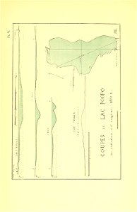
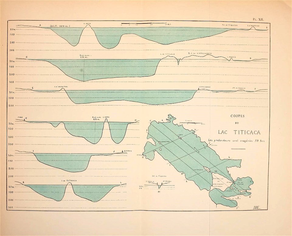
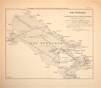
titicaca
maps
historical map collection
maps by john cary
titicaca
maps
titicaca
maps
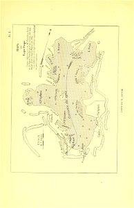
titicaca
maps
titicaca
maps
titicaca
maps
maps of agnano and grotta del cane by braun & hogenberg
bibliothèque nationale de france
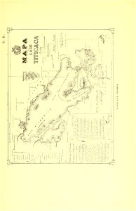
titicaca
maps
titicaca
maps
titicaca
maps
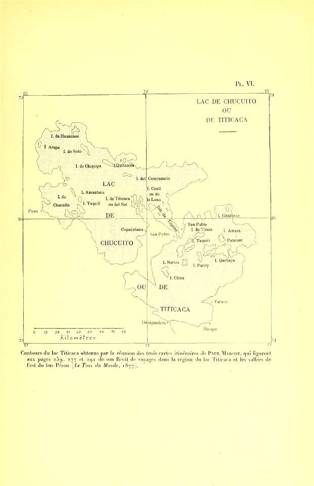
titicaca
maps
titicaca
maps
1760s maps of the americas
1760 maps
maps by joachim bormeester
1685 maps
surveying in the united states
1854 maps of california
peru. incidents of travel and exploration in the land of the incas
titicaca basin
maps of lindau (bodensee) by braun & hogenberg
lake constance in bavaria in art
maps of agnano and grotta del cane by braun & hogenberg
context files from gallica
old maps of lake titicaca
maps of lake titicaca
frank leslie's illustrated newspaper, 1891
frank leslie
101 - 200 of 337
Next page
/ 4